A Sampling of Architectural Surveys

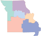
Select a county to view links to some of the architectural surveys, reports and maps held in the State Historic Preservation Office's inventory in Jefferson City.

Select a County

St. Louis County

Clayton - Carrswold Subdivision - (1980) - Carrsworld Subdiv Survey
Clayton - Claverach Park - (2014) - Claverach Park Report, Claverach Park Map, and Claverach Park Survey
Clayton - Phase I - (1985) - Clayton PI Survey
Ferguson - (1983) - Ferguson Report Ferguson Survey
Ferguson - Old Ferguson West - (2010) - Old Ferguson W Report, Old Ferguson W Map, and Old Ferguson W Survey
Florissant - (2003) - Florissant Survey
Jennings - (1985) - Jennings Survey
Kirkwood - (2004) - Kirkwood PIV Survey
Kirkwood - Phase I - (1981) - Kirkwood PI Report, Kirkwood PI Map, and Kirkwood PI Survey
Kirkwood - Phase II - (1981) - Kirkwood PII Report, Kirkwood PII Map, and Kirkwood PII Survey
Kirkwood - Phase III - (1986) - Kirkwood PIII Report, Kirkwood PIII Map, and Kirkwood PIII Survey
Kirkwood - Phase IV - (1988) - Kirkwood PIV Report, Kirkwood PIV Map, and Kirkwood PIV Survey
Ladue - Central Ladue - (1986) - Central Ladue Report, Central Ladue Map, and Central Ladue Survey
Ladue - Eastern Ladue - (1987) - Eastern Ladue Report, Eastern Ladue Map, and Eastern Ladue Survey
Lemay - Phase I - (1990) - Lemay PI Report, Lemay PI Map, and Lemay PI Survey
Lemay - Phase II - (1993) - Lemay PII Report, Lemay PII Map, and Lemay PII Survey
Manchester - (1983) - Manchester Survey
Maplewood - (1982) - Maplewood Report, Maplewood Map, and Maplewood Survey
Normandy - Spotless Town Survey - (2016) - Normandy Report, Normandy Map, and Normandy Survey
Oakland - Homes Designed by Harris Armstrong - (2012) - Oakland Report, Oakland Map, and Oakland Survey
Oakville - Historic Buildings, Phase I - (1988) - Oakville Report, Oakville Map, and Oakville Survey
St. Louis County - Art Deco and International Properties - (1987) - STLC Art Deco-IP Report STLC Art Deco-IP Survey
St. Louis County - Cemeteries - (2000) - STLC Cemeteries Report STLC Cemeteries Survey
St. Louis County - Churches - (1992) - STLC Churches Report STLC Churches Survey
St. Louis County - Meramec River South - (1992) - Meramec River South Report, Meramec River South Map, and Meramec River South Survey
St. Louis County - Mid-Century Modern Church Survey - (2010) - STLC Modern Church Report STLC Modern Church Survey
St. Louis County - North, Phase I - (1988) - STLC N PI Report, STLC N PI Map, and STLC N PI Survey
St. Louis County - Postwar Subdivisions - (2003) - STLC Postwar Subdiv Report STLC Postwar Subdiv Survey
St. Louis County - Schools - (1991) - STLC Schools Report, STLC Schools Maps, and STLC Schools Survey
Sunset Hills - Matetese to Sunset Hills, Phase II - (1989) - Sunset Hills Report Sunset Hills Survey
University City - Delmar Loop-Parkview Gardens - (1983) - Delmar Loop-Parkview Gardens Survey
University City - North Side - (1993) - U-City North Report, U-City North Map, and U-City North Survey
University City - Parkview - (1980) - U-City Parkview Map with Survey U-City Parkview Survey Part 2
University City - University Hills - (1986) - U-City Univ Hills Survey
Webster Groves - Gore-Lockwood District - (1983) - Gore-Lockwood Report, Gore-Lockwood Map, and Gore-Lockwood Survey
Webster Groves - Lee Street - (1980) - Lee Street Map Lee Street Survey Lee Street Map and Lee Street Survey
Webster Groves - Marshall Avenue Commercial District - (1983) - Marshall Ave CD Report, Marshall Ave CD Map, and Marshall Ave CD Survey
Webster Groves - Northwest Webster - (1985) - NW Webster Report, NW Webster Map, and NW Webster Survey
Webster Groves - Old Webster - (2004) - Old Webster Report, Old Webster Map, and Old Webster Survey
Webster Groves - Webster Park - (1982) - Webster Park Report, Webster Park Map, and Webster Park Survey

Ste. Genevieve

Ste. Genevieve - (1986) - Ste. Genevieve Survey

Stone

Galena - (1989) - Galena Report, Galena Map, and Galena Survey
Stone County - Towns and Rural Properties, Phase I (Northern) - (1993) - Stone TRP PI Report, Stone TRP PI Maps, and Stone TRP PI Survey
Stone County - Towns and Rural Properties, Phase II (Southern) - (1995) - Stone TRP PII Report, Stone TRP PII Map, and Stone TRP PII Survey

Taney

Branson - Lake Taneycomo Beach Towns and Resorts, Phase I - (1990) - Branson PI Report Branson PI Survey Part 1, Branson PI Survey Part 2, Branson PI Survey Part 3
Branson - Lake Taneycomo Beach Towns and Resorts, Phase II - (1991) - Branson PII Report Branson PII Survey Part 1, Branson PII Survey Part 2

Vernon

Nevada - (1992) - Nevada Report, Nevada Map, and Nevada Survey

Washington

Caledonia - (1978) - Caledonia Survey
Washington County - Rural Resources - (1985) - Washington Rural Resources Report Washington Rural Resources Survey

Worth

Worth County - Rural Survey - (1980) - Worth Rural Survey Report, Worth Rural Survey Map, and Worth Rural Survey
Worth County - Rural Survey - (1980) - Worth Rural Report, Worth Rural Map, and Worth Rural Survey

Statewide/Multiple County

African-American Churches in the Missouri Bootheel - (2001) - Report AA Churches in the MO Boothell Survey AA Churches in the MO Boothell
African-American Churches in the Missouri Bootheel - (2001) - AA Churches in the MO Boothell Report AA Churches in the MO Boothell Survey
African-American Schools, Phase I - (1999) - AA Schools PI Report, AA Schools PI Map, and AA Schools PI Survey
African-American Schools, Phase II - (2000) - AA Schools PII Report, AA Schools PII Map, and AA Schools PII Survey
African-American Schools, Phase III - (2002) - AA Schools PIII Report, AA Schools PIII Map, and AA Schools PIII Survey
African-American Schools, Phase IV - (2002) - AA Schools PIV Report, AA Schools PIV Map, and AA Schools PIV Survey
Antebellum Resources, Phase I (northern Lafayette County) - (1991) - Antebellum Resources PI Report Antebellum Resources PI Survey
Antebellum Resources, Phase II (parts of Johnson, Lafayette and Pettis Counties) - (1993) - Antebellum Resources PII Report, Antebellum Resources PII Map, and Antebellum Resources PII Survey
Historic Theatres, Halls and Opera Houses - (1998) - Historic Theatres Survey Part 1, Historic Theatres Survey Part 2
Log Houses (Boone, Callaway and Cole Counties) - (1973) - Log Houses Map Log Houses Survey Log Houses Map and Log Houses Survey
Mill Survey South Central Ozarks - (1995) - Mill Survey Report, Mill Survey Map, and Mill Survey
Missouri County Courthouses - (1970) - Missouri County Courthouses Survey
Ozark Native Rock (Jasper and Newton Counties) - (2016) - Ozark Native Rock Jasper-Newton Report Ozark Native Rock Jasper-Newton Survey
Route 66, Phase I - (1993) - Route 66 PI Report, Route 66 PI Map, and Route 66 PI Survey
Route 66, Phase II - (2003) - Route 66 PII Report Route 66 PII Survey
Tri-County Survey (parts of Andrew, DeKalb and Gentry counties) - (1979) - Tri-County Survey Report, Tri-County Survey Map, and Tri-County Survey

St. Louis City

1820-1920 Women and Clubs - (1996) - 1820-1920 Women Clubs Report 1820-1920 Women-Clubs Survey
Art Deco and International Properties - (1987) - Art Deco and IP Report Art Deco and IP Survey
Benton Park Neighborhood - (1979) - Benton Park NH Map with Survey
Carondelet - (2006) - STL City Carondelet Survey
Central Business District - (1979) - STL City 1979 CBD Report with Survey
Central Business District - (1985) - STL City 1985 CBD Survey
Churches of St. Louis City, Phase I - (1990) - Churches of STL City Report, Churches of STL City PI Map, and Churches of STL City PI Survey